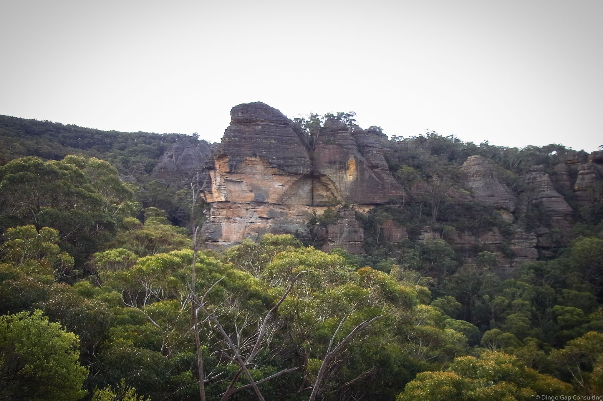
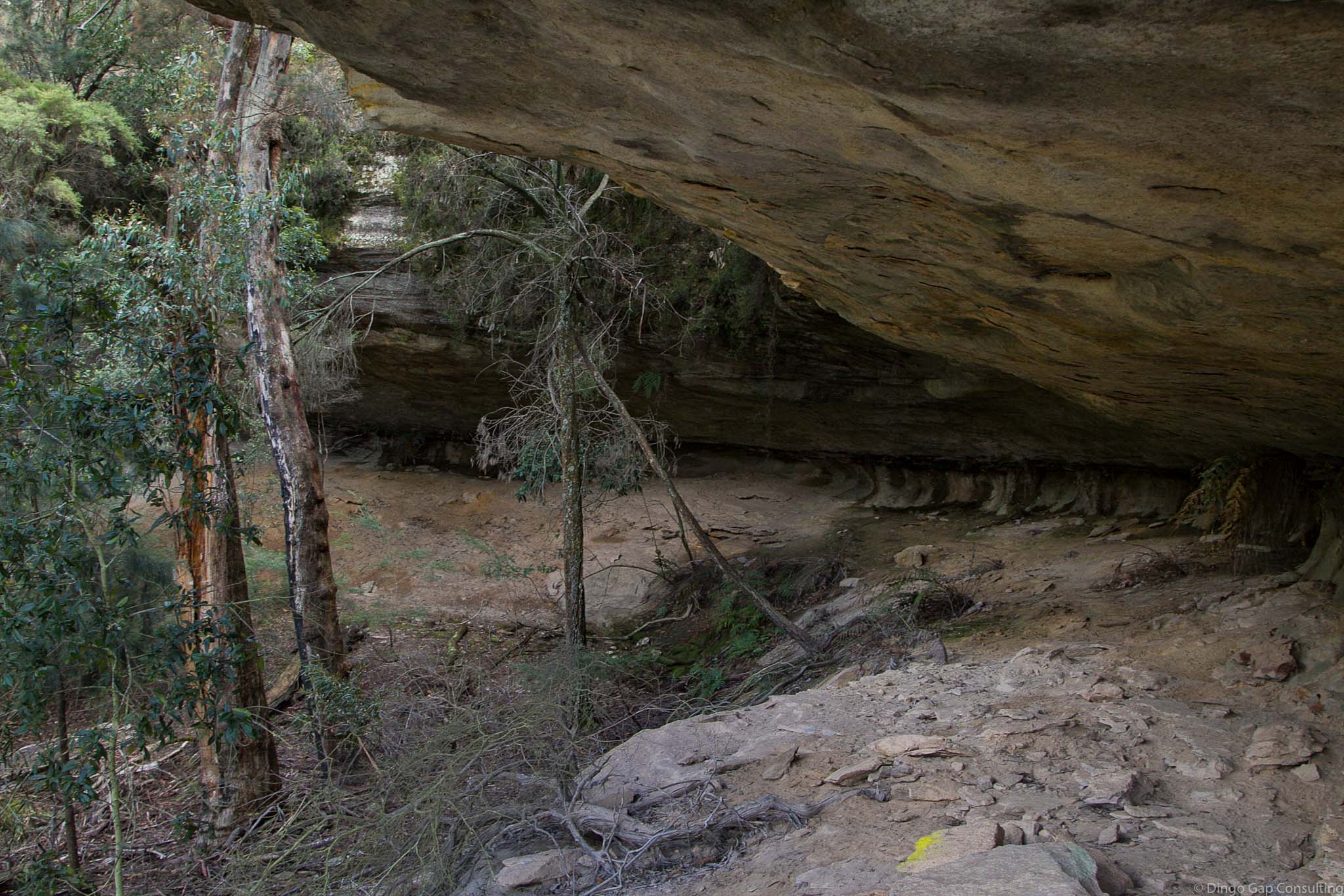
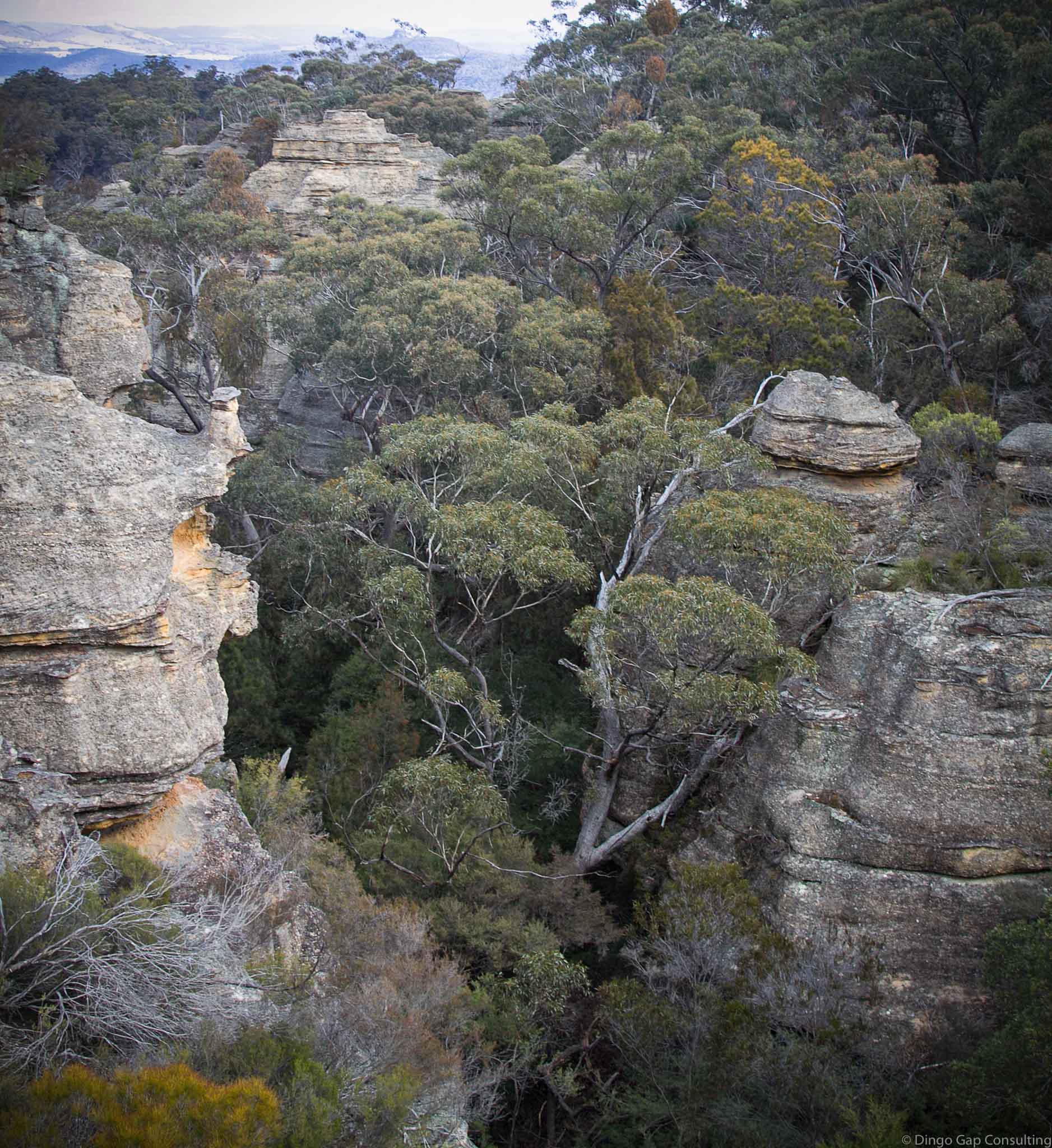
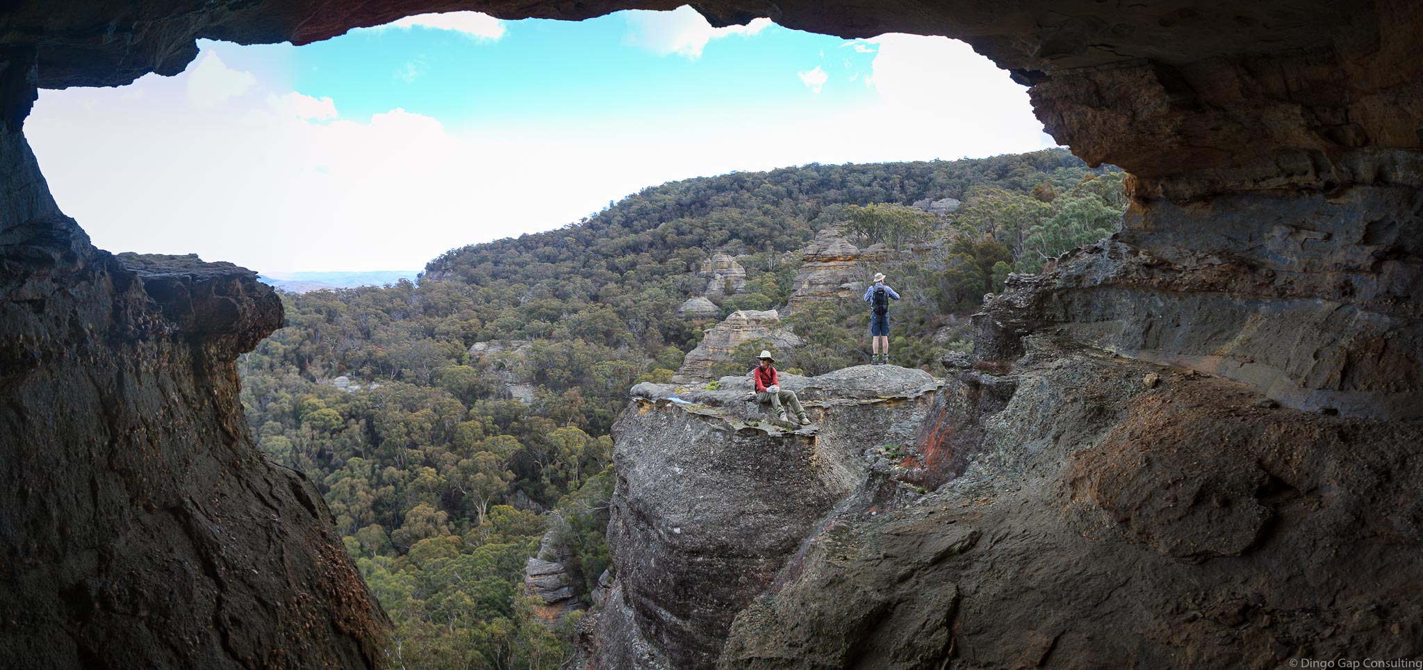
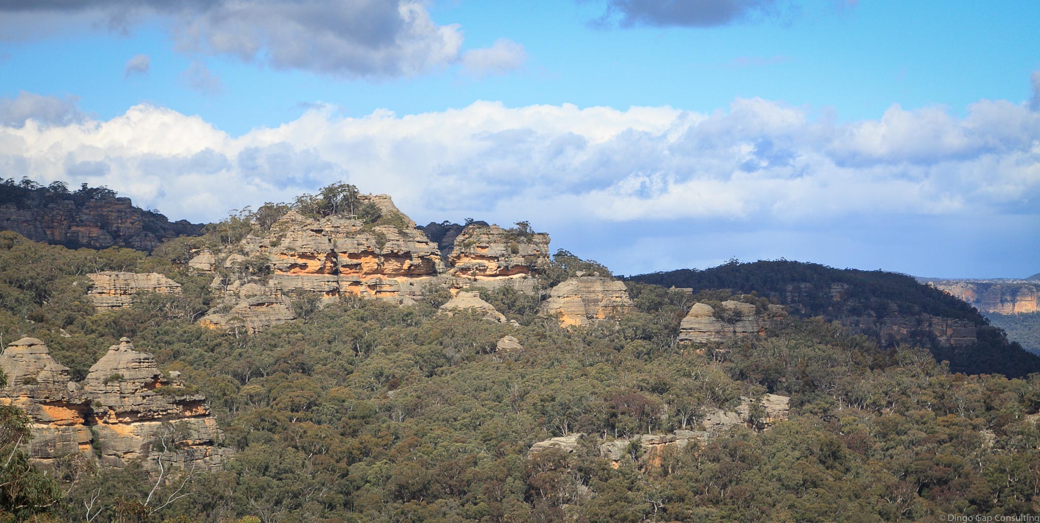
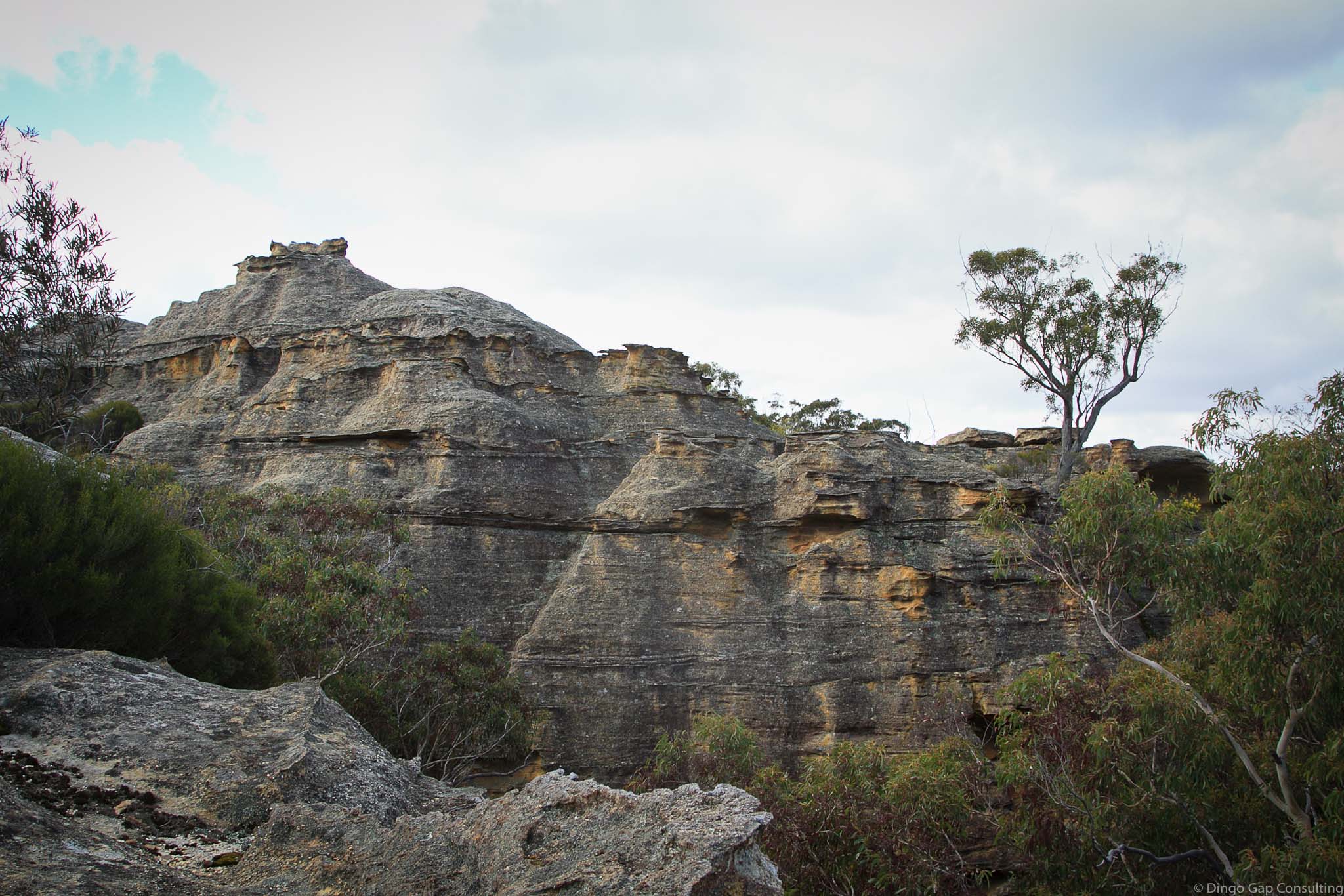
Gap Creek Pagodas surround Gap Creek which rises on the eastern slopes of Mt Airly.
Gap Creek flows down through Airly Gap to join with Genowlan Creek some 5 kilometres away.
The pagodas surrounding Gap Creek are huge. Stunning views can be seen from most of them. Well worth the effort to explore them.
• Exploring the Gap Creek Pagodas
• Mt Airly - The Southern Ridgeline, under the Great Wall and on to Airly Gap
Glen Alice 8931-4N
232 331
925 metres
Pagodas
Mugii Murum-ban State Conservation Area (NSW)
Airly
Roxburgh
The cableway at Airly runs from a point near the winding engine and boiler, south, up the steep slope and past the cliff line to...
Airly Basin is a small round hanging valley on the northern side of Gap CreeK, just a short walk from Airly Gap. The little valley...
Airly Frustum is a large cavern that has been eroded beneath the pagodas by water. The cavern is very narrow at the back, moist and...
Airly Gap is the main entrance by road to the newly created Mugii Murum-ban State Conservation Area. The Mugii Murum-ban State Conservation Area will protect...
Airly Gap Campground is a lovely sheltered spot at the gateway to Mugii Murum-ban SCA. There are no facilities - bring everything and take it...
Shale Oil Mining activities at Mount Airly commenced in the last 1880s and continued until the mid 1920s. Activity in the area was intense. Supporting...
The Airly Return Chute is a long gently sloping slot that provides a route through the Mt Airly cliff line just north of Airly Gap....
The Self-Acting Incline & Steel Rope Haulage Tramway at Airly ran from the end of the Southern Tramway to Capertee. It was a double track...
The Pagodas that mark Mt Airly's southern boundary are amongst the best to be found anywhere. High above the valley floor these dome shaped rock...
There were 2 main mining periods at Mt Airly. Each was serviced by its own tramway. A single track, narrow-gauge, horse-drawn tramway ran south then...
Airly Turret is a rocky peak about 2 kilometres south-east of Mt Airly and adjacent to the south-western slopes of Genowlan Mountain. The are excellent...
Airly Turret Slot is a large slot immediately to the north of Airly Turret. The slot is perhaps 100m long and almost 50m high and...
When Oil Shale Mining started in 1883 at Mt Airly and Torbane, a small village named Airly sprang up in the valley immediately to the...
Blacks Corner is a high promontory at the northern end of Mt Airly. There is a large basalt cap at the summit. On the northern...
The City in the Sky is a large outcrop of pagodas that towers over the Valley of the Kings and the Valley of the Dinosaurs....
Gap Creek is an ephemeral stream that starts in the gorges on th eastern slopes of Mt Airly, just west of Airly Gap. It flows...
Genowlan Mountain is a large mesa just north of the Gardens of Stone and east of another large mesa, Mt Airly. The mesas are separated...
Genowlan Pinch is a narrow defile allowing access through a pagoda cliff line on Genowlan Mountain. The slot is so narrow that you have to...
Genowlan Trig is some 3k SSW of Genowlan Mountain, located on the same mesa. Trees have regrown around the Trig but there are excellent views...
Mt Airly is a large mesas just north of the Gardens of Stone. Mt Airly was mined in the early 1900s for oil shale which...
Mugii Murum-ban is a State Conservation Area just east of Capertee, supposed to protect the significant pagoda landforms, slot canyons, endangered plants and birds and...
Paddys Mountain is the name used by Airly locals for the mesa between Gap Creek and Genowlan Creek. The name is shown on a sketch...
Point Hatteras is a promontory on the north west side of Genowlan Mountain. The western side of Point Hatteras is defined by high cliffs, mostly...
Saddle Lookout is a rocky outcrop on Mt Airly 400m west of The Towers and 1.4km south-west of Blacks Corner. As the name suggests the...
The Fort is a rocky outcrop surrounding spot height 935 on Fort Ridge, 2k south-west of Mt Airly. It is a bushwalker's playground - pagodas,...
The Great Wall is a sloping wall of pagodas that runs north-south along the western side of Mt Airly for more than 1 kilometre. There...
The Grotto is a small walk-through canyon between Point Hatteras & Genowlan Creek. Iron ladders, foot bridges & railings used to make it much easier...
The Ladders Defile is a small walk-through canyon that provides a route through the cliffs between Point Hatteras & Genowlan Creek. Rustic iron ladders make...
The Towers is a collection of large Pagodas just to the north of Mt Airly, on the neck leading to Blacks Corner. Like many of...
The Torbane Balcony is a ledge running for some 750 metres along the western face of the pagodas of Mt Airly's 'Great Wall'. The ledge...
The Torbane Blade is a tall shard of sandstone separated from the main cliff wall shaped rather like the blade of a dagger. The Blade...
The Torbane Oil Works were built on flat land close to the Airly shale mines. Torbane was serviced by a single-track railway, linking it with...
The Ultimate Chute is a very surprising route up through the southern cliff line of Genowlan Mountain. The top of the slot is just 200m...
The Ultimate Slot is a huge slot some 750m north of Genowlan Trig. It is possible to look down into the slot through a gap...
The Valley Of The Dinosaurs is a canyon about 300 metres north of Genowlan Trig formed by a Genowlan Creek tributary. The canyon runs north...
The Valley of the Kings is a deep gorge formed by a tributary flowing into Genowlan Creek. Huge pagodas adorn the cliff tops of the...