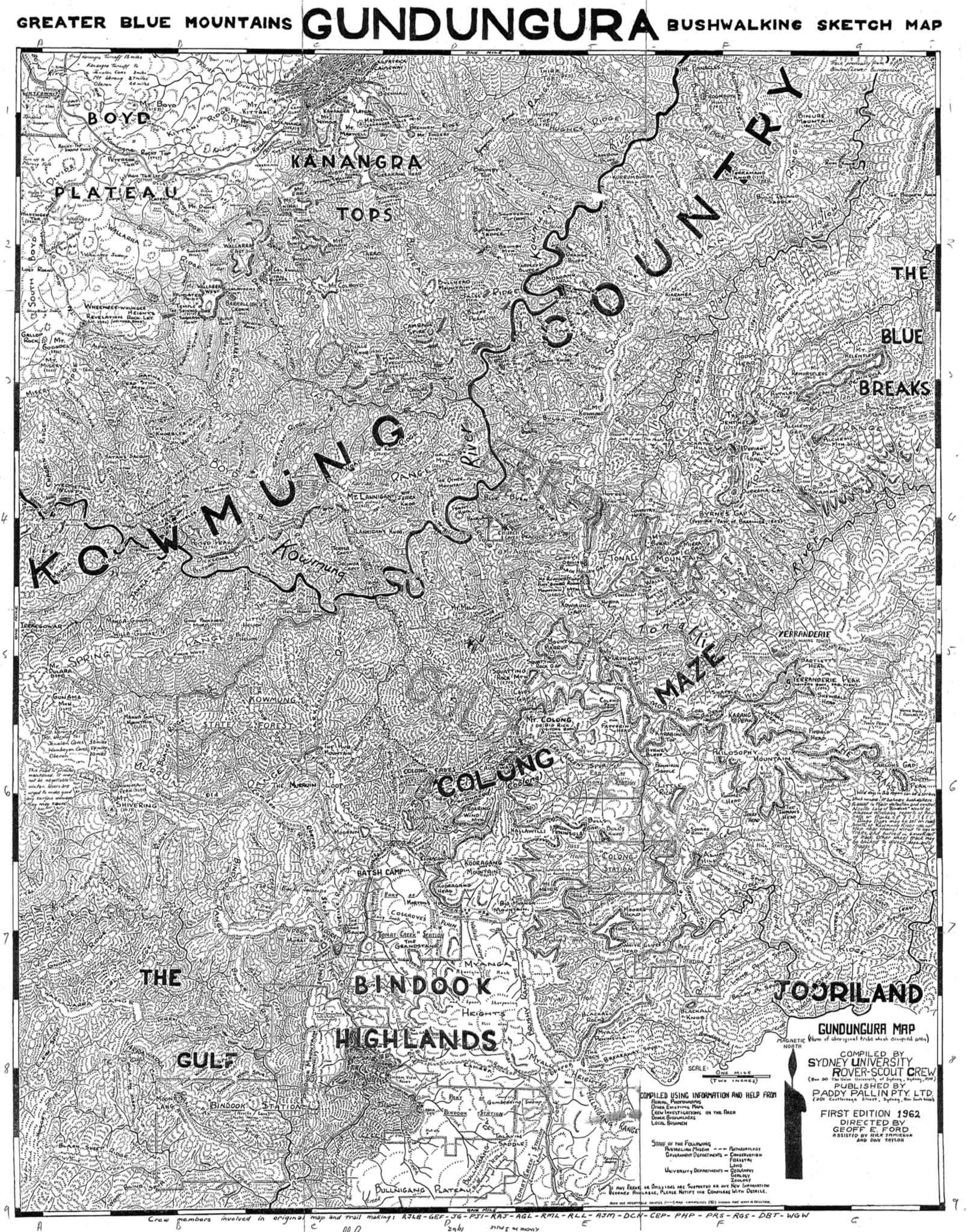
Gundungura Map - 1st Edition
The Gundungura Map was compiled from investigations in the area by members of SURC and other bushwalkers with help from local bushmen, and drawings by Geoff Ford from restricted (military) aerial photographs - starting with local Parish maps showing Yerranderie Goldfields.
The map used by bushwalkers at the time was the 1932 black and white version adapted by Myles Dunphy of “Blue Mountains and Burragorang Valley” Tourist Map of roadways and railways from Mittagong to Richmond.
You can read more about Geoff's story in The Whys Of The Kowmung Country And Gundungura.
Sydney University Rover Crew (SURC)
Paddy Pallin Pty Ltd
1962
PDF Version: (52467 KB)
JPG Version: (9313 KB)
Dr Geoff Ford has placed it in the Public Domain as a resource for bushwalkers and made this scanned copy available for download here.
There is no restriction on personal use or printing, provided the work is attributed to the Sydney University Rover Crew.
Thanks to Dr Ford and the Sydney University Rover Crew students of the time who walked with him and helped with the drawings for all the hard work required to produce this fascinating map.