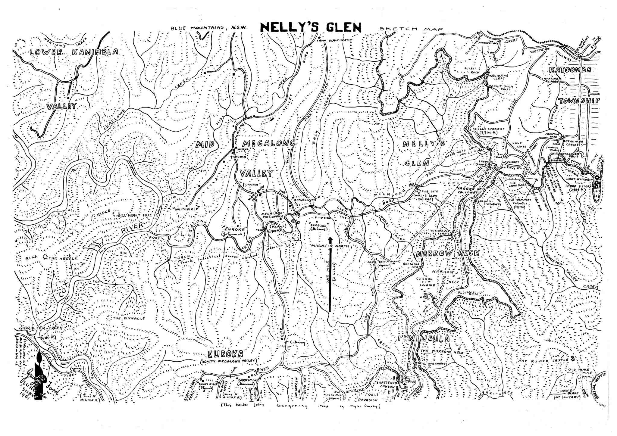
Nellys Glen Map
The Nelly's Glen map was sketched for Paddy Pallin because bushwalkers coming to his shop for advice asked for a map to get them in and out of Katoomba when using Myles Dunphy's popular 1953 Gangerang map. This was before the fire roads were bulldozed.
When Dunphy didn't supply a link, Paddy asked Geoff Ford (whom he had known through Geoff's dad). Geoff compiled it from family knowledge, local history - and whatever map sketches he could get his hands on). Sometimes he was accompanied on site by members of SUBW and SURC who were active walkers using Dunphy's Gangerang map.
Geoff Ford
1961
PDF Version: (597 KB)
JPG Version: (999 KB)
Geoff has placed the Nellys Glen Map in the Public Domain as a resource for bushwalkers and made this scanned copy available for download here.
There is no restriction on personal use or printing.
Thanks to Dr Ford and the Sydney University students of the time who walked with him for all the hard work required to produce this fascinating map.

